


Editorial note: This was updated after press to reflect the votes of the board from the meeting.
BRUNSWICK COUNTY — More development plans are appearing before the planning board in the state’s fastest-growing county.
READ MORE: 1,400 homes on the way to Brunswick, additional 1,700 tabled to next month
On Monday afternoon, the Brunswick County Planning Board will hear from multiple parties regarding planned developments desired for the region. If approved, they could result in almost 2,200 single-family units built in the unincorporated areas of Brunswick County.
The breakdown includes 1,676 single family units being scaled near Northwest, 204 near Bolivia, 299 near Sunset Beach and 15 near Supply. Below offers more insight into information that will be presented to the planning board — the board makes final decisions on development plan unless one is appealed to go before commissioners.
Check back for updates on whether the developments are approved after Monday’s meeting.
Folly Hills
The planning board approved the plan in a 4-1 vote on July 14.
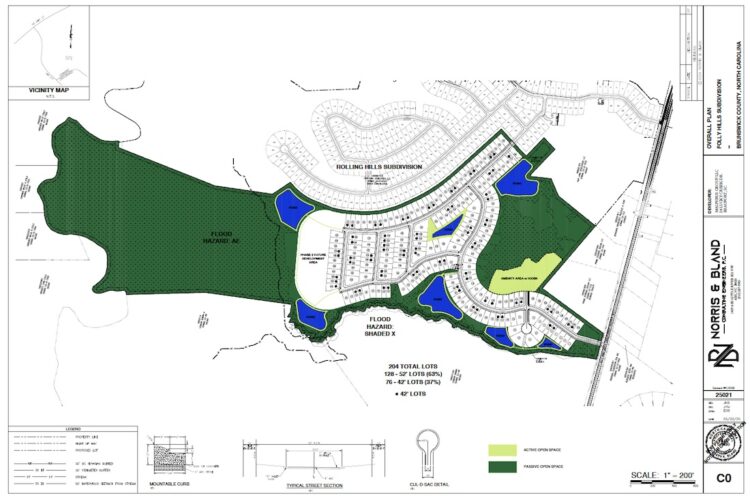
On 146 acres near Bolivia on Southport-Supply Road SE, Norris and Tunstall Engineering seeks site plan approval for a 204 single-family development.
The zoning district is low-density residential, R-7500, which allows 5.8 units per acre, and rural residential allowing 2.9 acres per unit. This project aims for 1.4 units per acre, each lot armed with a two-car driveway.
The development will have a 30-foot buffer to increase to 50-feet along the western periphery of the parcel. There also will be more than 200 feet of setback facing N.C. Highway 211 and a 10-foot easement within the street buffer to include a future greenway connection.
The developer is more than doubling the open space requirement from 36.5 to 94.3 acres, with 12.5 acres of recreational space, up from the 5.48 mandate. None of the lots, a minimum of 5,200 square feet, will be in a flood zone; around 65 acres make up wetlands. Stormwater ponds are constructed for a 100-year flood event.
It’s slated to bring almost 2,000 daily trips in a 24-hour period, according to the traffic-impact analysis. The developer is proposing road improvement, to include N.C. 211 access, with a westbound and eastbound turn lane with 100 feet of storage.
A driveway warrant analysis was done as well by RFK Engineers. A new full-movement driveway on N.C. 211 is proposed to be around 3,500 feet west of Old Lennon Road and a secondary access is “proposed via interconnectivity to the adjacent Rolling Hills Subdivision located to the east of the proposed development.”
Hooper Road
The applicant’s request to table their application was approved on July 14, and is set to be reheard August 11 with the intention of making changes to their original plan.
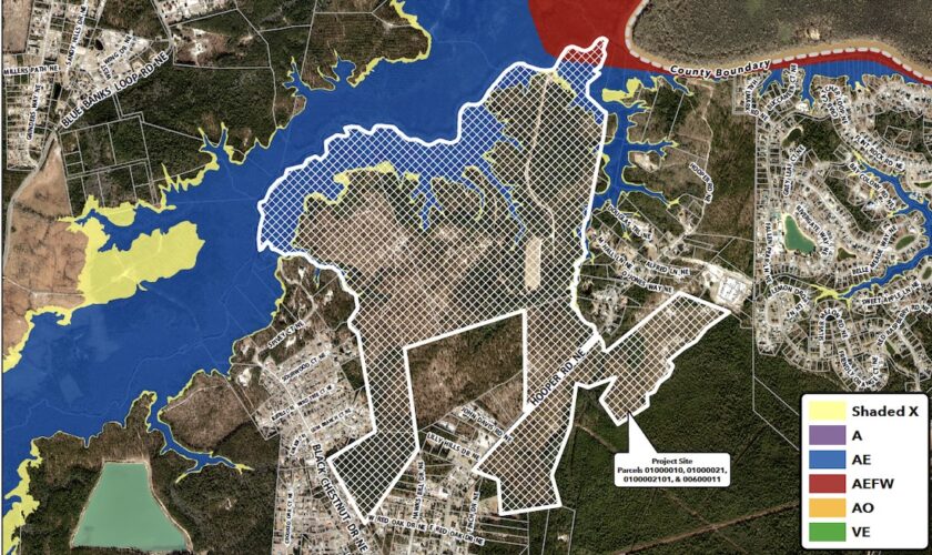
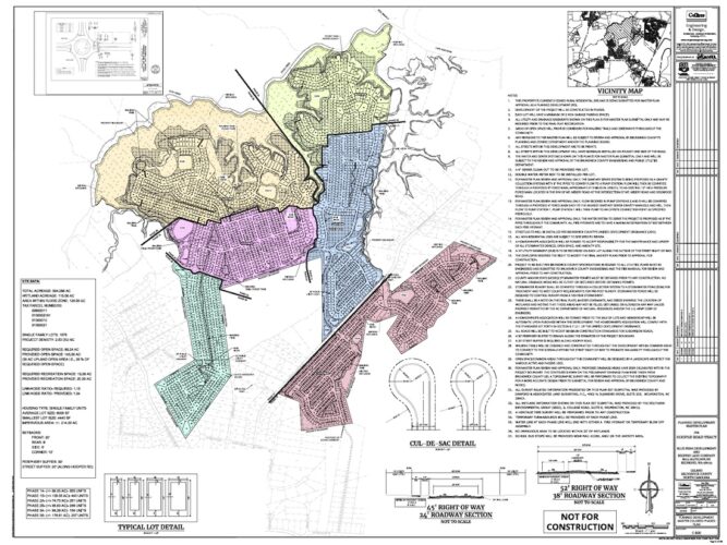
At June’s planning board meeting, Colliers Engineering and Design asked to table its proposal to bring more than 1,700 single-family units to 594 acres near Northwest and Leland.
Concerns from board members included traffic congestion, a single-entrance access point, and two emergency exits. The board feared the development may negatively impact homes needing support from emergency services, as the development is surrounded by other rural residential zoning and open conservation.
Since that meeting, the engineering group revised its three-phased plan, decreasing the unit count from 1,722 to 1,676, bringing it to 2.82 dwelling units per acre rather than 2.9. The development’s open space also has increased from 135 to 145 acres, more than the 89-acre requirement from the county. As well, 20 instead of 15 acres will be recreational — around 7 acres more than the mandate.
There will be a 30-foot buffer surrounding the perimeter with a 20-foot buffer around all 115 acres of wetlands. Lots ranging from 4,400 to 6,000 square feet, will be built outside of the flood zones and stormwater ponds will be managed to a 100-year event.
The development is poised to usher in almost 14,500 more trips to the area in a 24-hour period by the time it is completed, which could be over the coming decade.
Staff suggested 5% be workforce housing and a second entrance be constructed at Black Chestnut Road — or to create a gated emergency entrance at the very least. An emergency access road will be added to Dogwood Road at the end of Phase 1B, according to the plan; the phases include bringing 726 units in the first phase, followed by 529 in the second, and 421 in the third.
It’s unclear from the proposed site plan for Monday’s meeting if more entrances have been added to the development per the planning board’s concerns.
Member Jim Board said last month: “Logic says that’s not enough entrances into this huge development. If there was some sort of a disaster or a fire that they had to evacuate this, all coming out of just a couple of small emergency exits, it would be a nightmare, an absolute nightmare.”
Oxpen Oaks
The applicant’s request was unanimously denied by the planning board on July 14. The board voiced concern the development would negatively impact future residents due to it’s location within a flood zone.
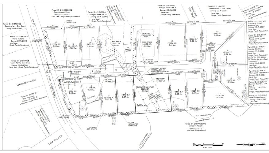
The smallest development to go before the planning board Monday will be the 6.67 acres for Oxpen Oaks Major Subdivision, located between Holden Beach and Shallotte. From Coastline Homes NC, LLC, the goal is to build 15 single-family homes, to take up 2.25 units per acre.
The project is located in a zone, R-600, which is high density residential, normally allowing up to 7.3 units per acre. A future land map denotes the area to be medium residential mixed. It will have a 10-foot buffer between C-LD property nearby and a 15-foot buffer along Oxpen Road.
The project exceeds by almost an acre the required open space and will have 1.4 acres, with half of it being recreational — also more than the 15% requirement.
A traffic-impact analysis isn’t warranted for the project, but permits from the United States Army Corps of Engineers and North Carolina Department of Water Resources will be needed as 0.07 acres is on wetlands with “the majority of this parcel is located in the shaded X flood zone and only lot 5 is in the AE zone.”
Lots will be 10,000 to 17,000 square feet and due to an unnamed tributary located on the site, a 30-foot riparian buffer will be required.
Sailors Haven
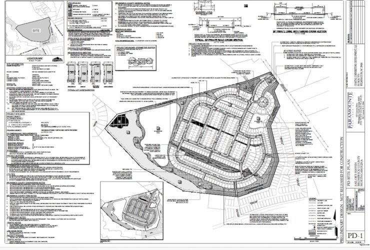
The planning board unanimously denied the development plan on July 14. The board was concerned about the plan’s single entrance, single emergency exit.
Another single-family unit development could be on the way to Sunset Beach. Sailors Haven is being proposed on roughly 117.3 acres from Coastal Cornerstone Development LLC.
Paramount Engineering is working with the applicant’s Seaside Road proposal, which has 20% of the project in the R-7500, which allows 5.8 units per acre, and 30% in CLD Maximum Density, approving up to 13.6 dwelling units per acre. This would allow around 731 units, but Sailor Haven requests to build 299 units on 4,800-square-foot lots, equaling 2.5 units per acre.
The project is bringing with it a greater degree of open space, 36.7 acres, than the 24 required — and recreational space will be 4.25 instead of the mandated 3.6. None of the site is in a flood zone, though 12.65 acres are wetlands; stormwater ponds will be built for 100-year storm events.
However, comments from the county technical review committee indicate the “site is located in Carolina Bay, which may present some drainage issues.” It indicates the fix would come with a properly devised stormwater system correcting problems with poor drainage soils.
Traffic is expected to be around 2,772 trips per 24-hour volume. A driveway warrant analysis also was conducted and found proposed road improvements would be needed. Suggestions include constructing a northbound left turn lane on N.C. Highway 904 with 75 feet of storage, as well as a southbound right turn lane on N.C. 904 with 50 feet of storage. Both would need the “appropriate full-width deceleration and taper lengths.”
Staff suggests an additional connection for emergency vehicles to access Seaside Road, with two stubouts for future connectivity. Also suggested is a 10-foot-wide access easement within the Seaside Road street buffer for a future pedestrian path or greenway.
Planning also requested a buffer on back-to-back lots and 5% be workforce housing.
Tips or comments? Email [email protected].
Want to read more from PCD? Subscribe now and then sign up for our morning newsletter, Wilmington Wire, and get the headlines delivered to your inbox every morning.
