
Update, July 8, 12:30 a.m.: Tropical Storm Elsa crossed into South Carolina at 11 p.m. Wednesday night. Winds were around 45 mph. Elsa will move through the greater Wilmington area today with widespread rain and isolated flooding. The five-county region is under a tornado watch until 9 a.m. Elsa will move out by 5 p.m. Thursday.
Update, July 7, 12:30 a.m.: Tropical Storm Elsa has strengthened into a hurricane and is located southwest of Tampa, moving 75 mph. The National Weather Service expects it to weaken upon landfall, and continue weakening as it travels up the coast to the Carolinas. Isolated tornadoes are possible, with winds gusts projected 30 mph to 40 mph.
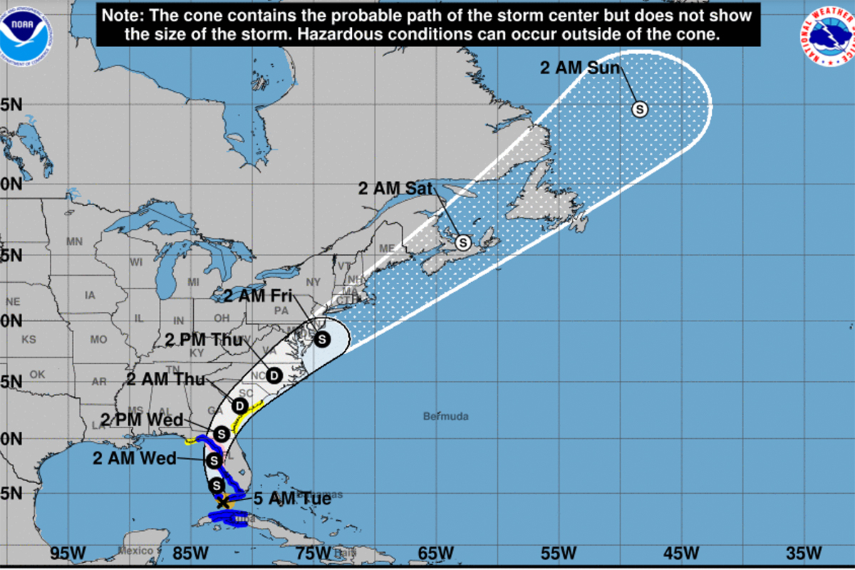
SOUTHEASTERN N.C. ––– Tropical Storm Elsa will reach the Carolinas Wednesday evening and linger through Thursday evening before heading further up the coast.
As of 5 a.m. Tuesday, the storm was approaching Key West with 60 mph winds and is projected to move northwest, crossing mainland Florida. Officials predict the storm will strengthen during this phase over the water before Elsa reaches the mainland.
It’s expected to weaken to a depression as it reaches the Carolinas. The region currently has no watches or warnings in effect, but that may soon change, according to the National Weather Service Wilmington. The region could see between 1 and 3 inches of rain, according to the latest forecast, with higher amounts possible.
When the storm approaches the Carolinas, heavy rain could produce isolated urban flooding, according to a 7 a.m. Tuesday NWS Wilmington forecast. Tornadoes are possible and wind gusts are projected to reach 35 to 45 mph near the coast.
The storm’s impact on the ocean will produce dangerous swells and increase the risk of rip currents for south-facing beaches on Thursday. By Thursday evening, local conditions are projected to improve as Elsa moves up the coast.
The next briefing is expected by 6 p.m Tuesday; this article will be updated with information thereafter.
Send tips and comments to [email protected]