
FORT COLLINS, Colorado – The first group of weather prognosticators issued predictions for the 2017 Atlantic Hurricane season, which runs from June 1-Nov. 30 each year.
Colorado State University hurricane researchers are predicting a slightly below-average Atlantic hurricane season in 2017, citing the potential development of El Niño as well as recent anomalous cooling in the tropical Atlantic as primary factors.
A weak La Niña this past winter has dissipated and there is the potential that a weak to moderate El Niño could develop by the peak of the Atlantic hurricane season, according to the report.

El Niño tends to increase upper-level westerly winds across the Caribbean into the tropical Atlantic, tearing apart hurricanes as they try to form.
A cooling in the tropical Atlantic over the past month could also provide a more stable atmosphere as well as drier air moving into hurricane season, both of which suppress organized thunderstorm activity necessary for hurricane development.
11 named storms
The CSU Tropical Meteorology Project team is predicting 11 named storms during the upcoming Atlantic hurricane season. Of those, researchers expect four to become hurricanes and two to reach major hurricane strength (Saffir/Simpson category 3-4-5), with sustained winds of 111 miles per hour or greater.
The team bases its forecasts on over 60 years of historical data that includes Atlantic sea surface temperatures, sea level pressures, vertical wind shear levels (the change in wind direction and speed with height in the atmosphere), El Niño (warming of waters in the central and eastern tropical Pacific), and other factors.
“So far, the 2017 hurricane season is exhibiting characteristics similar to 1957, 1965, 1972, 1976, and 2002,” said Phil Klotzbach, research scientist in the Department of Atmospheric Science and lead author of the report. “1957, 1965, 1976 and 2002 had slightly below-average hurricane activity, while 1972 was a well below-average season.”
The CSU team will issue forecast updates on June 1, July 3 and Aug. 2. This is the 34th year that the CSU hurricane research team has issued the Atlantic-basin seasonal hurricane forecast. William Gray launched the report in 1984 and continued to be an author on them until his death last year.
However, despite the encouraging forecast from Colorado State, it takes only one storm to make landfall and cause significant danger.
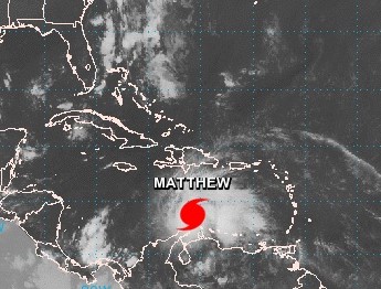
Hurricane Matthew proved that. A summary from 2016 Atlantic Hurricane Season is listed below. Memorial Day weekend 2016 was also a wash last season as a result of Tropical Storm Bonnie, which made landfall just east of Charleston, S.C., on the Isle of Palms on Sunday, May 29.
North Carolina requests $1 billion for Matthew damage
The 2016 Atlantic hurricane season was the first above average season since 2012, producing a total of 15 named storms, seven hurricanes and four major hurricanes. Damage from Matthew is estimated to be at least $15 billion along the eastern seaboard, making Matthew the ninth costliest Atlantic hurricane in history.
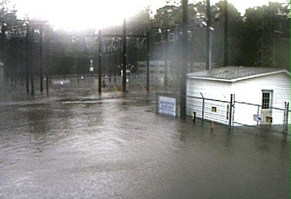
While Hurricane Matthew left Brunswick, New Hanover and Pender Counties with little to no damage, post-storm rivers cresting ravaged parts of the Cape Fear Region with massive flooding and road closures.
Hurricane Matthew dumped eight to 12 inches of rain across much of eastern and central North Carolina, and area that had already seen heavy rains ahead of the hurricane. Overall, the state suffered an estimated $4.8 billion in damage. The storm displaced thousands of families and damaged more than 98,000 homes and over 19,000 businesses. The hurricane and flooding caused 26 deaths in Tar Heel State.
North Carolina is asking Congress for federal assistance to help families, businesses and communities working to rebuild from Hurricane Matthew, Gov. Roy Cooper announced on Thursday.
“Matthew was so destructive that its name has been retired, but North Carolina will never forget how this hurricane turned life upside down for so many people in our state,” Cooper said. “We’re working closely with our local, state and federal partners to seek the resources needed to help storm survivors rebuild homes and help businesses and communities recover.”
Cooper’s administration is working with the state’s congressional delegation, led by Sen. Thom Tillis, Rep. David Price and Rep. David Rouzer, to advocate for the nearly $1 billion in additional federal dollars for unmet recovery needs. The new request reflects damage assessments compiled from all 50 disaster-affected counties.