
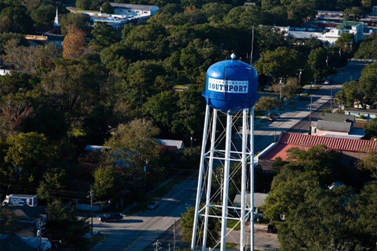
SOUTHPORT — The majority of Southport’s surveyed population is resistant to big changes, namely more residential development, though there are several areas they hope are addressed per the city’s new comprehensive plan.
READ MORE: Project Indigo back with new name, potentially less units, approved by county
The Southport Planning Board met before the holidays to hear a presentation from Stewart Consultants on its draft 2050 Comprehensive Plan, to go before the city’s board of aldermen in January. The plan is supposed to guide the town’s growth over the next several decades, and is based on stakeholder feedback and a resident survey with 536 responses (around 12% of Southport’s population).
According to the survey results, more than half respondents named slowing or managing development and population growth as top concerns. Behind them are upgrading infrastructure, maintaining a vibrant downtown, and preserving the natural environment.
Regarding priority levels, 85% of respondents named protection of marshes, wetlands, shoreline and environmentally sensitive areas; 84% said water quality in creeks, rivers and estuaries. More than 70% of respondents desire preserving historical sites, improving quality of utility services, supporting local businesses and improving stormwater management.
However, Southport may be forced to reckon with more threats in those areas, mainly due to the loss of its extraterritorial jurisdiction in July.
Southport’s ETJ — land outside city boundaries that municipalities still have some development and zoning authority over — was relinquished by the North Carolina General Assembly and given over to the county.
The city lost control of nearly 2,000-plus acres and 809 properties, many of them undeveloped nature, others zoned R-20 for low-density residential. When the General Assembly passed its measure in July, Southport residents and city officials feared not having control over the land would open the doors to unwanted development in some areas.
A lot of the residential land allows 5.8 dwelling units per acre. Under Southport’s domain, only 2 units per acre were allowed, which means the city’s outlying areas could see more population growth. This is already coming true — 326.9 acres of the former ETJ is being dedicated to the 1,100-unit Waterway development, formerly known as Project Indigo.
Stewart Consultants’ Jake Petrosky suggested the city officials look at potential zoning changes in abutting areas to mingle the ETJ with Southport’s corporate limits.
As part of the comprehensive plan, Stewart Consultants put together a future land use map and developed suggested character areas, including a new low-density/conservation designation. This character area is defined by half-acre lots — or smaller clustered lots — designed amid conservation areas with a minimum of 40% open space.
Petrosky said the city could consider creating a conservation subdivision design option and even allow them by-right to encourage developers.
“This is the stuff people would like to see more of,” Petrosky said. “So that’s what we wanted to make sure we convey as you have conversations in the future about new development and how it could be tailored to meet what people want to see.”
Other character areas include:
- Historic neighborhood: Mostly single family homes
- Traditional neighborhood: Single-family residential with some mixed housing
- Low- to medium-density residential: Mostly single family, three to four lots per acre
- Office and institutional: Mainly daytime or early evening offices, government uses
- Industrial: Land adjacent to Duke Energy and discharge channel
- Highway commercial: Larger footprint, higher density commercial, retail and services
- Downtown commercial: Historic commercial core, active storefronts
- Midtown commercial: Small- to medium-scale boutiques, retail, restaurants
- Gateway: Medium-scale uses, including retail and restaurants
- Neighborhood commercial: Small-scale non-residential uses with use restrictions and design details to limit impact
- Waterfront commercial: Bald Head Island ferry service, Fort Fisher ferry, Yacht Basin District and marina, includes hotels, restaurants, retail, docks, boardwalks
- Parks and open space: Floodplains, wetlands, sensitive areas and parks
Based on the desires of surveyed Southport, Stewart Consultants suggested limiting density, building size and building height to encourage a development pattern aligned with Southport’s character. As for the latter, the firm proposed no permitted buildings higher than 60 feet, the average height of the town’s many oak trees.
However, the consultants did recommend the town incorporate mixed-use and conditional zonings into its development processes — two development components the board of aldermen has scorned in the past. Some are concerned it will open Pandora’s Box to higher density development.
Conditional zonings are when a use is proposed for an area that is not allowed by-right and can be approved at the municipality’s discretion. Southport’s land code only allows it in commercial districts, not residential.
A year ago, the newly elected board of aldermen tabled a text amendment to the city’s land code that would allow conditional zonings to exist in any district and create a custom conditional zoning not tied to any other district.
“The candidates that were elected were very upfront about their position on conditional zoning in Southport that has the potential to change the complete makeup of our city, double the population, depending on who we have on this board,” resident Francesca Slaughter said at the December 2023 swearing-in of new Southport officials, particularly Frank Lai and Rebecca Kelley.
Petrosky said the expansion of conditional approval should be considered in the effort of increased flexibility, which can mutually benefit developers and the city.
“It is a tool in the toolbox that can allow dialog and can be used to accomplish your goals in a number of different ways and it can accomplish things that you can’t easily accomplish in other ways,” Petrosky said.
For example, conditional zoning would help the city improve affordability within its bounds, with allowances such as accessory dwelling units and allowing for a mix of housing types in a majority of residential zoning districts.
Stewart Consultants’ plan also includes mobility improvements across the town, including the expansion of parking options. The city commissioned a parking study earlier this year to analyze the implementation of paid parking, but the consultants did not recommend metered parking at the time. Still, Stewart Consultants said the town has plenty of areas, mainly in its right-of-ways, to add parking spaces, whether paid or not.
Parking is most needed in the Yacht Basin, the consultants reported.
Conveniently, the 2050 Comprehensive Plan presentation was followed up with a proposal for a parking overlay district in Yacht Basin. The district would formalize and upgrade privately-owned off-street parking among Moore Street, Bay Street, Caswell Avenue and Yacht Basin Drive. It also calls for landscaping to mitigate impacts to surrounding properties, predominantly residential.
The district also calls for a new traffic pattern and pedestrian walkway along Yacht Basin Drive.
The parking improvements in this area coincide with the comprehensive plan’s goal of taking advantage of the city’s waterfront amenity.
“It lends itself well to be a real strategic planning tool for this, for the city, if they’ll use it as such rather than check the box and put it on a shelf,” Planning Board Chair Sue Hodgin said.
After the aldermen review the plan in January, it will be assessed by Division of Coastal Management staff for CAMA compliance, then back to Stewart Consultants for finalization.
Reach journalist Brenna Flanagan at [email protected].
Want to read more from PCD? Subscribe now and then sign up for our newsletter, Wilmington Wire, and get the headlines delivered to your inbox every morning.