
NEW HANOVER COUNTY — Cape Fear residents will have to wait a bit longer for any news on what may or may not happen on the western banks of the Cape Fear River. It’s been over a year since two development proposals came before New Hanover County for large scale mixed-use projects that have raised concerns from environmental groups, city and county staff, and community members.
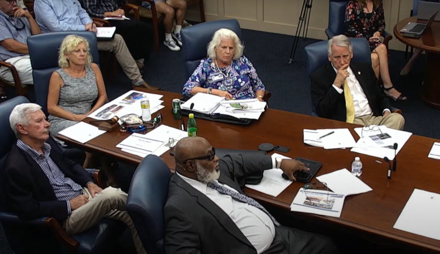
County commissioners met Thursday for a second work session to discuss possible land-use scenarios and what the investment — monetarily, environmentally, and labor-wise — would be to proceed.
The consensus was that more detailed technical studies are needed to shape any long-term decisions and policies.
“This is not something we need to rush into,” Vice Chair Deb Hays said to the media after the meeting Thursday. “I realize there’s a lot of people wanting something to be done, but we’re going to do it right. That is the right thing to do.”
County director Rebekah Roth spearheaded a presentation that county staff spent six months researching and laid out five possible options: conservation, limited use, working waterfront, small-scale mixed-use and larger urban mixed-use. She detailed the pros and cons of each.
One thing “off the table,” Roth explained, was single-family residential construction.
“Single homeowners would be the most vulnerable to the flood risks,” she said. “Investment to that level of development would be hard to offset in terms of value provided by those homes.”
Roth seemed to steer away from complete conservation as it would take tax revenues off the table. She explained the land has a $16-million tax value, if developed.
On behalf of county staff, her recommendation is to offer a mix of limited-use, working waterfront and small-scale mixed-use, seemingly pausing large-scale development options. Roth said working toward a middle ground most aligned with the county’s comprehensive land-use plan and future vision and with “sensitivity to natural resources.”
“But it would have to be done thoughtfully,” she said.
According to a March briefing before the first work session, the county’s future land use plan originally indiciated support of more intensive development with a long-term vision to mirror downtown Wilmington. County staff opinions seemed to have changed following concerns from stakeholders and the community.
The county plans to update its zoning policies to align with its vision. Each of the scenarios laid out would involve some form of private investment, trade-offs, and impacts.
It could be more than eight weeks before follow-up feedback would be brought before the board again, but commissioners agreed taking the time is worth it.
“It’s easy to move ahead quickly and then regret a decision 10 years down the line,” Zapple said. “I don’t want to see us do that.”
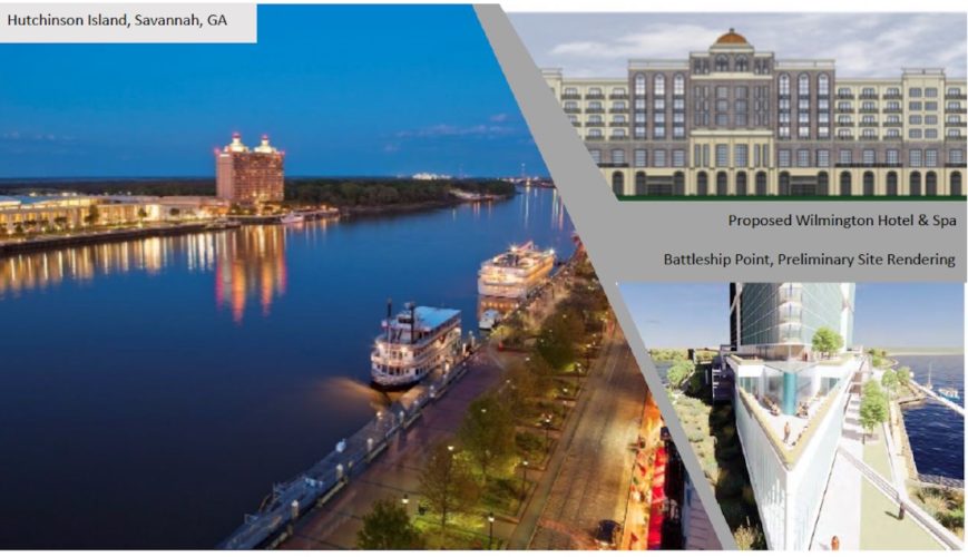
The top-of-mind concerns from commissioners, as well as opponents to recent development proposals like Battleship Point and Wilmington Hotel and Spa, are with the environment — specifically, flooding and preservation of wildlife.
Yet, other concerns lie with traffic and future transportation projects, as well as water and sewer infrastructure. The county also is weighing options on how to best work with stakeholders, such as current property owners and state and federal agencies.
“You can throw money at anything and make it work,” Hays said. “Does that mean it’s the right thing to do for the future and years down the road? No.”
What about the environment?
First and foremost, Roth explained it’s the “footprint,” not necessarily scale, of future construction that could impact the shorelines of the Cape Fear River and associated wildlife habitat. As a result, any sort of development on the western banks would likely face some environmental pushback.
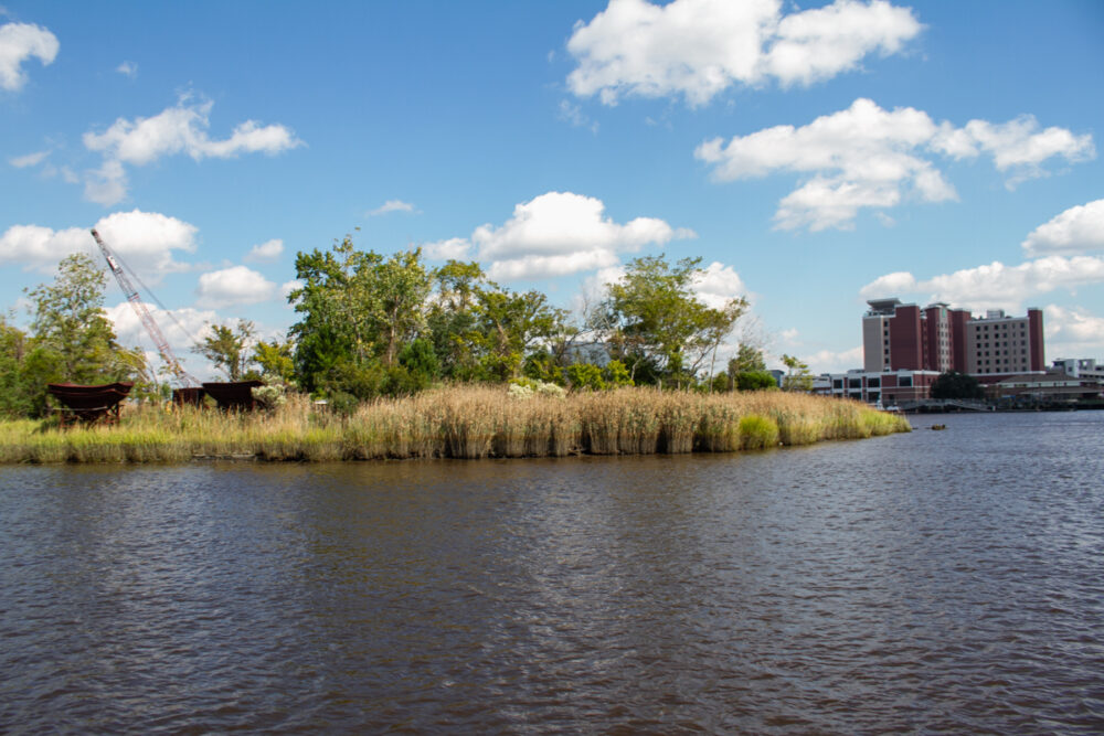
Major concerns staff said need more examination include climate change, sea-level rise and flooding that already occurs. In 2020, Eagle’s Island, for example, experienced 174 flood events, according to Unique Places to Save’s scientist Christine Pickens. UP2S is working to conserve 83 acres of Eagle’s Island, located south of the USS Battleship.
Roughly 70 acres is in an AE flood zone, meaning a special flood hazard area where risks are very high and there’s a 1% chance of flooding each year, based on FEMA’s flood risk maps.
“In addition, historic data shows the number of flood days in the area have been increasing over the past 40 years,” Roth explained.
Dr. Rob Young, director of Western Carolina University’s Program for the Study of Developed Shorelines, who spoke at the first western bank work session on March 31, referenced a study by Horry County in South Carolina, conducted in 2020.
Roth said the study, “looked at flood data from Hurricane Florence and Matthew, compared that with FEMA data, and used this information to support additional development regulations.”
However, she explained to commissioners the county has to tread lightly using the information. Local governments have limited authority in dictating land use and policy concerning potential future flooding scenarios.
“In terms of zoning and development regulations, because the [future flood] models are based on assumptions, they have not been used in the past to make zoning decisions,” she said. “The question is: Is a particular proposal going to meet regulatory environmental standards that are not normally applied by local government? If you can meet those standards, then you are able to build.”
The county can’t dictate an ordinance on future presumptions, but any building would have to comply with state and federal regulations.
A more refined zoning plan would help determine what can be done.
“It would provide more information on height, scale, opportunities for open space and public amenities,” Roth said, “and the use most in line with our goals for the area.”
Conservationists worry the estuarial nursery grounds along the shorelines would not sustain dense development and historians want to salvage its cultural heritage steeped in Gullah Geechee artifacts, dating back to the 1700s.
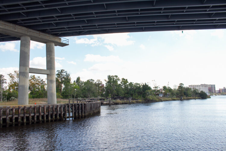
The land — between the Cape Fear Memorial Bridge and Isabel Holmes Bridge — is mostly designated industrial heavy use, first implemented in the 1970s. It was once utilized by manufacturing, maritime industry and warehousing.
“One thing I’m really not excited about is any of the heavy manufacturing that has gone on over there,” Hays said after the session. “I want to see it cleaned up and create a beautiful space across from downtown Wilmington, which is so beautiful, so viable, I want to make sure we augment that.”
Thursday, Roth explained there are two businesses currently operating as such — one is a houseboat manufacturer preparing to relocate.
Commissioner Rob Zapple said no matter which direction the county went with in its policymaking, the area needs brushing up and asked staff to come up with a ballpark figure as to what it might cost the county.
Hays asked which areas of the property are brownfield sites and how the government could support those efforts.
“The bottom line is, there are issues, and even if we do nothing and leave it in a beautiful state, we gotta clean it up,” Zapple said.
What about infrastructure?
While the land’s hydrology, soil compaction and flood risks are priority, traffic and emergency access capabilities remain of concern as well.
Commissioner Zapple was worried about how emergency vehicles could access the land, especially during flood events. He also indicated the need to expand services if people are going to work or live across from downtown, along the Highway 421.
Water and sewer infrastructure would be required in the three possible land-use options Roth suggested, as it would invite people to the area for recreation, some business use and tourism.
The cost to run main lines would depend on Cape Fear Public Utility Authority’s requirements in terms of pipe size and length, she explained. The pipes would have to run under the river, which would also be difficult to maintain, Commissioner Jonathan Barfield expressed.
In the last five years, commissioners have invested in extended utility access along Highway 421, but future capacity could conflict with current needs, according to staff. If the western banks were developed, it would cut into the allocated capacity for other projects slated for development or recently built, including Riverlights.
Future transportation projects would be at stake also, according to the county. Staff noted it would have to look at how any across-the-river enterprise or development would influence area needs.
An intersection improvement for Isabel Holmes is slated for construction in 2028 in the draft of the NCDOT’s 2024-2033 State Transportation Improvement Program. The project, along with the Rail Realignment — to connect New Hanover County with Navassa across the river — and even the replacement of the Cape Fear Memorial Bridge all need to be taken into consideration. Building on the western Cape Fear shoreline would affect progress or access to the western banks.
How vehicles enter and exit the land need to be further examined. When the Peter Point plan was presented, preliminary analyses indicated the potential need for accessing the northern banks off U.S. Highway 421.
A potential “right-in, right-out” loop would need to be created per NCDOT standards, depending on the outcome of a thorough traffic impact analysis.
“We don’t currently have the information at this point as to what amount of traffic would trigger that requirement,” Roth explained.
What about future development?
There are about seven to 10 property owners identified on the western banks that have been a part of county staff’s conversations, as well as stakeholders from North Carolina Department of Transportation, Wilmington Urban Area Metropolitan Planning Organization, N.C. Department of Environmental Quality, Cape Fear Public Utility Authority, Historic Wilmington Foundation, and Coastal Federation.
“Any major development in this area will likely be subject to all review bodies after initial zoning,” Roth said. “But they would need to see site-specific plans to see how it would apply.”
She was referencing state and federal agencies who also have to approve permits and regulations for any building.
“They’re not geared to inform upfront policy decisions,” Roth added, when Barfield asked if they could be looped in beforehand to assist in any decision-making.
The main players in future development would be the most impacted by any county decisions.
Commissioners agreed to reassess and put to a vote Battleship Point’s requested proposal to create a new riverfront urban mixed use zoning district, which would update the 2007 riverfront mixed-use district. The item was tabled in January and county manager Coudriet recommended denying it for now until more studies are conducted.
“That gives the developer some predictability to know this isn’t going to happen right now,” Barfield said to the media after the meeting. “But it gives us some time to get all the right answers, and I think that might help inform their decision as well in the long term on what they should and shouldn’t do.”
KJF Development has asked the county to rezone two parcels, totaling roughly 29 acres, into a high-rise, mixed-use development, consisting of three towers, 240 feet each, with 550 condos, 300 apartments, a hotel and commercial space. It also noted it would seek a brownfields agreement with the state to clean up industrial contamination.
Roth pointed out the development team’s land is also suitable for potential offshore wind — an element that could be included in the working waterfront option.
Working waterfront — essentially featuring marine-like industries — wasn’t initially considered as an option due to its unappealing visual aesthetics that may not align with downtown Wilmington. But based on research, and the county’s April economic mobility study, Roth found offshore wind typically requires 20 to 25 acres of land for adequate use, and the northern area where Point Peter is would be the only fitting piece.
KJF would have to willingly work with the county to utilize any of their land. (Representatives from KJF didn’t respond to Port City Daily by press.)
“We don’t have any indication any property owners would be interested in anything other than being able to use their property in a way that makes sense in terms of their investment,” Roth said.
While Wilmington Hotel and Spa doesn’t need commissioners’ approval for rezoning, it would require careful attention to ensure appropriate and supportive infrastructure is in place.
Diamondback Development, the land owner, was working with resort-builder Bobby Ginn to construct the project on Eagles Island, lush with wetlands and cultural heritage. The hotel is currently on hold as conservation nonprofit group Unique Places to Save wants to conserve its 83 acres and turn it into a public park.
UP2S put down a $100,000 payment on the land last month and is working toward raising $16 million by the end of the year to buy Eagle’s Island.
“While our particular project was discussed, it lacked the sense of urgency it deserves,” newly appointed UP2S executive director Clark Harris told Port City Daily after watching the meeting.
He warned if urgent action isn’t taken, the land in question will be developed, and “dialogue around public use of that land will stop completely.”
“Our application of a $12 million NC Land and Water Grant will be decided in one month and having the support of local municipalities would be helpful,” Harris said.
Tips or comments? Email amy@localdailymedia.com.
Want to read more from PCD? Subscribe now and then sign up for our morning newsletter, Wilmington Wire, and get the headlines delivered to your inbox every morning.