


WILMINGTON — Visitors to Downtown Wilmington might notice something unusual hovering across the Cape Fear River as the North Carolina Department of Natural and Cultural Resources conducts a series of tests to determine the potential impact a proposed development could have on the city’s skyline.
Eight to 10 foot balloons, flown 75 feet above the ground, will be placed along Battleship Road to judge the impact that several buildings could have on the views from Downtown Wilmington.
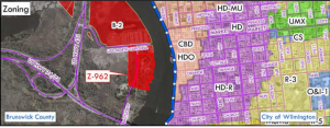
The development in question is proposed for 125 Battleship Road and spans both New Hanover County and Brunswick County. The developer submitted an application with New Hanover County in March that is still awaiting a public hearing from The New Hanover County Planning Board after it was continued several times earlier this year.
The rezoning application filed with the county calls for a conditional zoning district that would allow the developer to construct a 15-lot residential neighborhood on 13.98 acres, changing the land from B-2 to R-10.
County staff submitted their recommendation to not approve the rezoning request. The staff report states it was not consistent with the direction the city and county are hoping to move toward.
The recommendation states, in part: “The application is not consistent with the purposes and intent of the 2016 Comprehensive Plan because the proposal will not support a mixture of compatible uses as encouraged in the Urban Mixed … Not reasonable and not in the public interest because the subject property has high-visibility, is located along a public shoreline and immediately adjacent to a historic area of the County with rich natural resources, and there is insufficient information in the application or to ensure that the County’s economic, cultural, and natural resources will be protected.”
Renee Gledhill-Earley, an environmental review coordinator for the state, said that after receiving the negative feedback on a housing development, the developer is now hoping to use the land for a mixed-use development.
“(The) First proposal was for about 15 high-end houses with river frontage and dock. That would have required zoning change that county indicated would not pass. Developer now proposing mixed use with plans as shown,” Gledhill-Earley said.
To show the potential visual impact of the mixed-use development, Jay Shott with Diamondback Development requested the State Historic Preservation Office to determine the effects these buildings could have on the view-shed if built to current zoning regulations – the plans submitted would not require a rezoning.
Shott submitted plans to the State Historic Preservation Office with seven buildings on the property, four of which would be 75-feet tall, and three parking structures. Two of the parking garages would be four floors with green roofs, and one two-story deck, also with a green roof.
According to Deputy State Historic Preservation Officer Ramona Bartos, the best way to determine the impact these buildings could have on the view from Downtown Wilmington is to fly balloons 50-feet apart on the footprints of each of the four buildings.
After the balloon test has been conducted, the next step would be to use the results of the test to, “… create photo-simulations that show the types of buildings and associated amenities that could be built within the footprints and heights of the four mixed-use/residential structures,” Bartos said.
Flooding
“There are no plans to raise Battleship Road. This roadway has historically flooded during king tides and heavy rainfall storm events … Every developer we have talked to about the property in question has been informed about this as well.”
Another problem with the property is the flood potential, according to county staff.
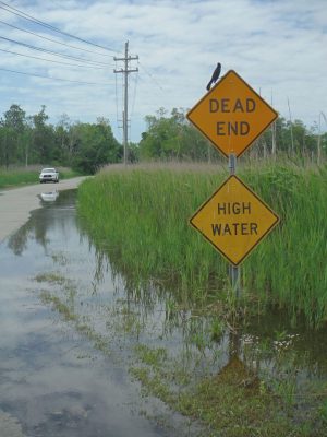
“Portions of the property are located within an AE Special Flood Hazard Area, with a Base Flood Elevation of 9 feet. The proposed preliminary flood maps expand this flood zone to cover the entire property,” according to the staff report.
According to NCDOT Communications Officer Brian Rick, flooding along Battleship Road is not something the NCDOT is looking at fixing.
“There are no plans to raise Battleship Road. This roadway has historically flooded during king tides and heavy rainfall storm events. It’s the nature of a very old road built at this location next to the river. Every developer we have talked to about the property in question has been informed about this as well,” Rick said.
Messages left for the developer were not returned before publication.
Battleship Road balloon test by Michael James on Scribd
Michael Praats can be reached at [email protected]
